Author

Yonder Girl

Browsing

Last month, Mom and I went to Wells Hill Park in Fayetteville, TN to hang out with friends. The last time we saw them was right before the COVID-19 pandemic started. We arrived at the park before them and waited in excitement. Thankfully, we didn’t have to wait long. They arrived a couple of minutes after us. In the parking lot, we all excitedly greeted each other with long-overdue hugs and immediately started to talk. We moved our conversation to the adjacent pavilion where we savored delicious Crumbl cookies. Yum! There is no such thing as a favorite Crumbl cookie because they are all way too yummy.

I wish we were Hansel and Gretel because we needed a cookie crumb trail to follow since it was a bit hard to tell where the actual trail was at first. So instead, we walked in the mostly dry creek bed. As we wandered through the creekbed, my friend and I talked about books, school, and our new friends. Along the way, we saw flowers here and there scattered on the bank. We were so engrossed in our conversation about the Hunger Games series that we almost got separated from our moms. It was fortunate our moms were keeping an eye on us and alerted us to come back. We reunited with them by following a branch of the creek bed where it rejoined the trail.

My friend and I hiking in the creek.

They stopped us in the creekbed in order to take a picture. That’s when things went awry. While we stood in the creekbed surrounded by the high bank, my friend heard a hissing sound near us and yelled ‘Snake!’. We both immediately darted to safety (next to our moms) on the path. We were scared, but mostly startled. The snake was only a couple of feet away from us and didn’t look venomous. Just like us, the snake darted to safety, but not to its mom. It was also scared, but mostly startled. I hope it knew humans aren’t venomous.

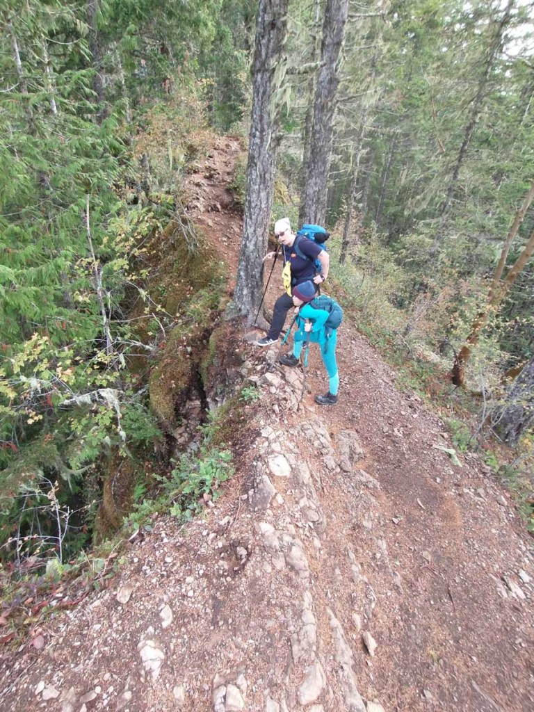
After our reptilian encounter, we turned left at a bench on the trail. Soon after that, the trail became challenging where it crossed a small ravine. Our friends aren’t experienced hikers, so we all decided to go back the way we came and turned right at the bench instead. We did not regret going this way. Along the trail, we saw a giant patch of trilliums and other flowers, which were all gorgeous. The trilliums we saw weren’t exactly common. In fact, the specific species that we found, the sweet white trillium, is actually quite rare. For more information on the sweet white trillium, click the link here.

The sweet white trilliums

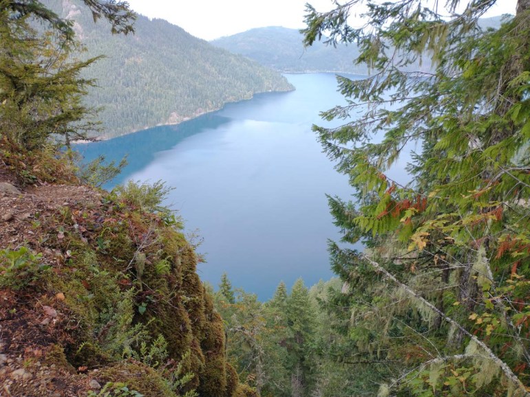
We continued past the beautiful trilliums and heard the sound of falling water. To me, it sounded like a loud, fast-paced pattering. When we heard this, we knew it was a waterfall. We looked down and saw a creek. Unfortunately, if we wanted to get to the creek, we would have to go down a slippery, muddy, and wet slope. Thankfully, there was a handline, which is basically a rope used to help someone climb. Using the handline, we slowly and carefully inched down the hill one at a time. After finally reaching the bottom, we walked a short bit and saw a pretty, tiered waterfall. Despite all of the bugs, the falls were still beautiful. After our moms were done taking pictures and my friend and I finished singing “We Don’t Talk About Bruno” from Encanto, we went back up the muddy hill singing “I Want It That Way”. After we finished singing, my friend and I started to talk about more music that we love. After a little bit, we started to chat about school, and before long, we were back at the parking lot. We sadly had to say bye, but we promised to hike together again in the future.

Our turn-around point on the hike.

Right now you can see one of the most beautiful natural sights in Alabama in its most stunning state, but it won’t last much longer. Alabama’s Cahaba lilies are going to peak very soon, like in a week or so. Also called shoal lilies, Cahaba lilies are gorgeous and rare with large white blooms. The Cahaba National Wildlife Refuge (NWR) conserves the largest stand in Alabama protecting these delicate aquatic plants. It is also one of the best places to visit the lilies. Cahaba lilies typically bloom from Mother’s Day to Father’s Day. 

Dad and I sitting a rock with some Cahaba lilies in the foreground.

Be Prepared

Before you go, make sure to check the weather and flower forecast. The reason you want to check the weather is so you don’t get caught in rain and swept away by a swelling river. You also want to check the flower forecast so you can actually see the flowers. You definitely don’t want to drive a long way only to be disappointed. Last year, we made the mistake of not consulting the flower forecast and ended up driving 2 hours to see a very brown river. It was full of sediment, which also delayed the blooming time. 

Gear and Supplies 

  • Quick-dry clothes or swimwear
  • Water shoes
  • Hiking poles
  • Bug spray
  • Sunscreen
  • Sunhat
  • Sunglasses with polarized lenses*
  • Life vest for young swimmers
  • Water and snacks
  • Camera
  • Waterproof bag for electronics
  • Towel
  • Change of clothes

*Polarized lenses cut glare on the water’s surface making it easier to see where you are stepping.

Dad and I carefully walking through the water using hiking poles.

Getting There 

Once you enter the Cahaba NWR, you will drive on a one-lane, unpaved, dusty, gravel road. Watch for other cars and pedestrians. There are multiple spots to park along the road, but the best place for access to the lilies is just past a small beach with a sketchy rope swing. The small beach is on the left and the small parking area is on the right.

Onto the Lilies

To see the lilies, you will be walking through fast-moving water anywhere from ankle-deep to hip-deep; or if you’re short like me, prepare to swim. Under the water’s surface, the terrain is uneven and rocky. Some of the rocks move and others are slippery. Definitely, watch where you step. Not just for your safety, but also so you don’t trample the plants or squish the snails. They are both absolutely everywhere. Take your time and plan on spending at least an hour exploring the river and flowers, more if you plan on swimming or taking LOTS of pictures like Mom. 

Me crouching down slightly so it looks like the water is really high up.

These flowers are a must-see for the Alabama outdoor enthusiast. If you want to learn more, visit here. For our family, this is a Mother’s Day tradition. This would also be a great outdoor water activity. So if you want to get outdoors but not hike, this is perfect. I hope you decide to go! 

Me standing behind some lilies smiling.

Hey guys! 

On Day 3, we completed our High Divide Loop camping trip. We were originally planning to stay on the trail for one more night, but we all wanted to get off the trail. The downhill terrain gave us confidence that we could easily complete the High Divide Loop on this day and not need to camp an additional night. The night before, as I mentioned in the last post (go read if you haven’t yet), I was doing calculations on how long the hike back to the car would be. It was 7-8 miles and I guessed we would get back to the car by 5:00 if the trail was downhill or flat.

We were expecting warm and clear weather, which was a happy change from the last two days and nights. We were still high up on a mountain, therefore, it was still cold when we woke up and got ready to leave. This was when we all noticed the gorgeous view at our campsite. In between some trees, we could see Mt. Olympus and Blue Glacier. Once we saw Miss Shanna again, she mentioned how she heard that the view was a rare sight. We didn’t see it when we arrived because it was dark and cloudy. After we finished packing up and admiring the view, we started the third section of our hike.

Mt. Olympus and Blue Glacier
Mom and I putting away part of the tent.

As we slowly went down the trail, we finally saw Heart Lake. As expected, it was heart-shaped until we got further down the mountain and hiked closer to the lakeshore. When we reached Heart Lake, the lake appeared to be more of a U-shape. We stopped to fill our bladders and explore the lakeshore. While we were there, we found out that we stayed at the wrong campsite. This was where we were supposed to stay the night before. As we were filtering water, Mom and I watched a little bird bouncing around in the lake. It was adorable. It dived, stayed under for a couple of seconds, then jumped out of the water.

Hiking down to Heart Lake.
Heart Lake.
Heart Lake and its amazingly reflective water.
Looking out on Heart Lake
The view reflecting onto the lake.

As we continued on the trail, the lower in elevation we got, the less ice and snow we encountered. I thought the third day was a lot easier than the other two days, other than the distance of course. Unfortunately, after we entered the forest, we didn’t see a lot of great views, but the few we saw were of snowy mountains. They were pretty, but we had been in the snowy mountains for a couple of days by now, so it wasn’t anything new. It would probably have been more impressive if we had hiked the other direction toward the snowy mountains. We continued to make our way through the forest and eventually decided to take a snack break. After a while, the trail temporarily flattened where we had to cross a wide creek, but thankfully it was shallow. Soon enough, we reached Rocky Creek.

Mom and I taking our snack break and enjoying some mint tea.
Me crossing a creek.
Rocky Creek.

Originally, we planned to camp at Rocky Creek and hike for four days rather than three. We could’ve stopped because we had a permit to stay here for the night, but we all wanted to get off the trail. As we resumed hiking and said goodbye to what would have been our campsite for the night, we were surrounded by the forest. It was pretty with all of the greenery and mossy rocks. We soon reached one of the Sol Duc campsites and decided to stop for another snack break there. Afterward, we continued hiking for one to two miles and then saw a little hut we saw on Day 1. This meant we were close to Sol Duc Falls, which meant we were close to finishing the High Divide Loop. We were soon on a wider trail; that’s when we started seeing more people, a very good sign because it meant the parking lot was getting close.

The forest.
Dad and I taking a break at the campsite.

We soon got to Sol Duc Falls, but I was super tired so we took a quick break. After we finished the break, we persisted because we wanted to get off the trail. When we ran into the little bridge we saw at the beginning of our hike on Day 1, I was happy. We were so close to the end! I started walking faster until we reached the last hill where I practically ran up it. And that’s when we saw the most glorious sight of all …the parking lot. We hobbled over to our car and put away our packs. I was so happy about being able to sit on something soft.

Almost to the car.

Because we finished the hike a day early, we had to find a place to stay. We tried the lodges in Olympic National Park, but they were full and had no more rooms. So we went back to Port Angeles to find a place to stay. Thankfully, we found a room at the Quality Inn where finally got to take showers! We were also grateful for food. I was excited to eat something that wasn’t freeze-dried. When we were picking up dinner, we found an ice cream truck called Welly’s Real Ice Cream. It was the best ice cream I’ve ever had! It tasted fresh and natural. I got the strawberry. Usually, I don’t like strawberry ice cream, but this was amazing. This was the perfect way to end our day and hike.

Mom and I posing with our Welly’s ice cream.
An old, rotting log that looks like a platypus.

Hey Guys! This post is just in time for Valentine’s Day! Read on for my heartache and foot ache hiking to Faux Heart Lake.

Day 2 was less eventful than Day 1, except for when we parted ways with Miss Shanna and discovered Mom’s big camera no longer worked. Miss Shanna returned to the trailhead the way we came, and we continued on the High Divide Loop. I was kind of sad to say bye for now. After saying goodbye, our family explored the Lunch Lake area and admired the ice formations. That’s when we discovered that Mom’s camera wouldn’t turn on. Unfortunately, the night before Mom forgot to put her camera into her sleeping bag, and it settled into retirement as a very expensive brick. At least she had her phone and she could still take pictures with that.

Mom and Miss Shanna saying bye.
Lunch Lake in the morning.
Some cool ice formations (pun intended).
Me holding a giant piece of ice. I wanted to lick it, but Mom said no.
Some strange frost/ice.

We thought the trail was going to be 4 miles going downhill, but you’ll soon see that was a lie. When we left Lunch Lake, we had to backtrack UP the icy, stone stairs. I thought that was fun; Mom not so much. I practically ran up the stairs, which I later regretted when I became hangry. Once we got up, we continued past the boulder sandwich and back onto the High Divide Trail. I didn’t eat much for breakfast and burned my energy running up the stairs, so I was kind of tired and cranky plus I wanted a real sandwich. 

Lunch Lake a little later in the day.
Me being crazy and energetic on the way up the stairs, which I later regret doing.

We continued on the High Divide Trail, sandwichless, and saw stunning red fall foliage and towering, snow-capped mountains. This part of the High Divide Trail offered views towards the southwest over the Hoh River and Hoh Lake until you reach Bogachiel Peak. It was nice to finally see the scenery I hiked so hard to reach instead of blizzard conditions like the day before. Eventually, we took a break at a scenic overlook to eat a light lunch of salami and other snacky foods. Not a sandwich, but still good. I’ll take it, mostly because I didn’t have a choice. During this break, I also played in the snow. 

One of the many views that we saw on the way to Heart Lake.
Some of the red foliage.
The border in between the foliage and the snowy rocks.
Another picture of one of the many views.

As we continued past Bogachiel Peak and crossed the ridgeline, our view changed to the north and we could now see down into Seven Lakes Basin. I was so tired and cranky (still) that I didn’t fully appreciate the spectacular view, but I did count more than seven lakes. As we continued, I got even more frustrated because there were a LOT of PUDs (pointless ups and downs). When we saw a lake that looked like a heart, we all got excited because we were planning to camp at Heart Lake campground. Turns out it was a different lake, and I started to feel hopeless and we would never reach our campsite. Shortly after Faux Heart Lake (really called Lake Number 8), we got to somewhere that looked like our campsite. Since it was getting dark, we set up camp here. 

I am not amused.
Seven Lakes Basin
A picture of beautiful scenery and Faux Heart Lake.
The REAL Heart Lake.

The campsite was nice except there was no water source nearby. It had two trees perfectly spaced for the hammock fly that we use for sheltering our cooking station. There was a big empty, flat spot for our tent. Water wasn’t a big issue that night because we still had plenty in our bladders. That night, we didn’t know about the amazing bonus we’d get the next morning.

Our campsite.
Me being cold but happy because I was eating food.

I don’t remember what we ate (according to the photo, we had beef stroganoff), but after we finished dinner, we all started getting ready for bed. When we were all settling into our sleeping bags, I stayed up for a little bit, looking at the trail map for Day 3 because I didn’t want to be disappointed again. Once I was done, I put the map in one of the tent pockets and went to sleep. Not too long after, we heard noises outside of our tent. We heard leaves crunching and twigs snapping like something or someone was walking through the forest. We also heard some snuffling and shuffling. We think it was a BEAR, right outside of our tent. Thankfully, we didn’t end up becoming a triple-stuffed bear burrito. And that was the end of Day 2. Have a Happy Valentine’s Day! Read the next post about finding my “heart” on the High Divide Loop.

A selfie before we went to bed.

Hey guys! This post is about the big hike we did at Olympic National Park, the High Divide Loop. One little tip for when you’re backcountry camping in this kind of environment, it’s good to check the weather the day before you begin. Actually, ALWAYS check the weather before any hike. That’s Leave No Trace rule #1. Y’all will see what I mean soon enough. I hope you all enjoy it! 

On Day 1, we hiked 8.4 miles from Sol Duc Trailhead to Lunch Lake. On this day, Miss Shanna joined us on the trail. At the start of the hike, Dad realized he forgot his hat and turned back to the car to get it. He told us to keep going, and he would catch up. He caught up to us when we paused to take pictures at a small bridge crossing a little stream. Afterward, we continued until we got to a bigger bridge crossing the Sol Duc River at 0.2 miles from the trailhead.

Miss Shanna and I led the way on the hike.

This bridge is the best place to view Sol Duc Falls, which is magnificent! The Sol Duc River spills over a rocky precipice where it splits into three waterfalls that rejoin at the next tier of rock before flowing together once again as a single river. It was so loud, I felt like it was going to burst my eardrums. The waterfall misted all over the bridge making a layer of muddy, slippery leaves. Of course, we took photos and selfies before continuing on our way!

All of us taking a selfie at Sol Duc Falls.
Mom and Miss Shanna taking pictures of the Sol Duc Falls.
Sol Duc Falls
The view of the Sol Duc River from the other side of the bridge.
Dad and I hiking up towards Deer Lake.

We continued along our hike until we got to Deer Lake. Along the way, we looked at fungi and other cool bits of life, and continued to climb higher up the mountain. As we went up, I saw snow on the taller mountains and was ecstatic. There was a chance I would get to play in the snow! After seeing it in the distance, I wished for snow on our hike too. Immediately, Mom, Dad, and Miss Shanna were like, nooooo. We ate lunch at Deer Lake where we saw no deer. Just as we would have no lunch at Lunch Lake because life is just crazy like that PLUS Lunch Lake was still literally miles away. No exaggeration. What we did see at Deer Lake were beautiful fall foliage and tranquil waters. Since it was a bit chilly, I got out my puffy coat to stay warm. Mom shared a Seattle Chocolate bar, which is the BEST chocolate in the world.

Deer Lake
Hiking past Deer Lake

Back on the trail and past Deer Lake, we continued to climb a steep incline and were now on the High Divide Trail. Sprinkled along the trail were small alpine pools and lakes and SNOW! Somewhere between Deer and Lunch Lakes, Miss Shanna split off because she is MUCH faster than us and could arrive at Lunch Lake campground faster by herself. We decided to split the group because we needed to secure a good campsite since the weather was turning nasty. As we gained elevation, the temperature dropped drastically. The light sprinkle of rain soon became a light sprinkle of snow, which became heavy snow. At first, I was happy, but as we continued, I felt miserable. We were cold and wet. The snow only fell harder and harder until we could barely see 100 feet in front of us. This really slowed us down. We were looking for a fork in the path. Miss Shanna said earlier to turn left once we saw two trees sandwiching a boulder. When we finally got to the boulder sandwich, I was so elated and more than a little relieved. A short and snow-covered spur trail led to an icy stone staircase that steeply plummeted down to the lakes. It was scary.

Alpine pools just pass Deer Lake
Happy when the snow started. Not so happy later.
Dad and me hiking in the snow. Less happy about the snow.
Snowing harder.
I rested at the boulder sandwich since the snow was coming down hard at this point.
Our destination, Lunch Lake.

At one point, Dad almost slipped on the steps. While we were on the stairs, we saw a round lake and thought it was Lunch Lake. Unfortunately, it was a different lake, called Round Lake, and the one further away was Lunch Lake. When we reached Lunch Lake, we celebrated and took lots of pictures by the lakeshore, then we started looking for Miss Shanna. We looked for a while and couldn’t find her. At that point, we were pretty worried. Just as we started to put down our packs to search more diligently, she found us. We followed her to the campsite, and it was a great one. The trees blocked the strong wind and blowing snow. The ground also didn’t have any rocks, and pine needles cushioned the tent. After we set up our tent and unpacked our sleeping gear, Mom and I huddled together in the tent under our rumpl (not a spelling error) down blankets and my sleeping bag. We were sharing body heat because it was frigid and we were shivering. I would guess it was 20°F or less. While Mom and I huddled in the tent, Dad made dinner. Once it was ready, we hesitantly got out to eat. I didn’t eat much, and as soon as I could, I went to bed. Mom came to bed after me. A magical moment during the night was when Dad came back with water bottles filled with hot water for Mom and me to warm our sleeping bags (see camping tip below). We all went to sleep. That was the end of Day 1.

Camping tip: a sturdy plastic water bottle filled with hot water can keep you warm when you sleep with it in your sleeping bag. Remember when I said you should always check the weather before going on an adventure? Well, this is the moment. If we hadn’t checked the weather, we wouldn’t have had the water bottles to make the magical moment happen.

Some weird lichen that we saw.

Hey guys! I’m writing about my second day at Olympic National Park. These hikes were a lot more relaxing than Mt. Storm King. We did one small easy hike, one longer easy hike, and one partial easy hike.

Hoh Rainforest is one of the few remaining temperate rainforests, and I got to see it! I, of course, loved it. When we arrived, we first went to the Hoh Rainforest Visitor Center. That’s where I got my Junior Ranger activity book. The first hike we did was to the Hall of Mosses Trail. We took forever on this short trail because I was completing the Junior Ranger activity book. Despite looking at an activity book during most of the hike, I saw six banana slugs and moss on what seemed to be ALL of the trees. During this hike, Mom came up with the idea of having a competition. The competition was who could find the first banana slug. Guess what? I found the first banana slug. I WON! The banana slug was long and skinny. I was super proud of myself. I tried to convince Mom to let me get a phone as my prize, but that didn’t work. So we settled on horchata instead. 

The first banana slug.
Working on the Junior Ranger Program.
A weird log spotted along the Hall of Mosses Trail.
A tree covered in moss.
A nursery log, which is a fallen log that has a bunch of new(er) trees growing from it.
Me holding a leaf the size of my head.
Dad and me hiking.

After we finished the Hall of Mosses Trail, we did the Spruce Nature Trail. I paid more attention to this trail since I was done with the Junior Ranger activity book. We were faster, but still kinda slow because Mom and I were taking LOTS of pictures. At the beginning of the trail, Mom spotted a Roosevelt elk hiding in the forest! It looked like an everyday normal elk and it had big antlers. I think it was male, but I couldn’t get a good look at it. The elk was too close to the trail, so we went around very carefully. The trail branched off with a spur trail leading to a riverbank and a partially dry riverbed. The riverbed was covered with rocks worn smooth and round over time.

The Roosevelt elk next to the trail hiding in the mossy forest.
Me taking a picture of Dad at the riverbank.
Me in front of a really big tree with epic pancake stack fungi.
Some mushrooms with a couple flowers above them.
Me snuggling with Stripes.
Me and Stripes by the Hoh River.
Logs covered with moss.
Me hiking through the forest.
Younger trees growing out of an older, dead one.

After we finished the Spruce Nature Trail, we started on the Hoh River Trail. We didn’t want to complete it since the trail is about 26.3 miles one-way. It wasn’t as exciting or beautiful as the other trails, but it was still nice. Our turnaround point was one of the many river access points. We spent a little while down by the river to take pictures and then turned back to leave. Sadly, we saw 2 dead banana slugs on the way back. Rest in peace banana slugs! It looked like someone stepped on them. Seeing them like that was quite saddening.

Me next to the Hoh River Trail sign.
Hoh River Trail.
The scenery close to the river.
The river and mountains.
Me running on a log.
The mossy forest.
One of the squirrels we saw up close.

On the way back to our VRBO rental in Forks, we saw a whole herd of Roosevelt elk. It was awesome. After taking pictures, we sent them to my grandma. She somehow thought they were elephants. Huh?!?!? Maybe she thought their butts were ears? Overall, it was quite a relaxing day compared to the day before.

The herd of Roosevelt elk we saw on our way back to the VRBO.

I hope y’all enjoyed reading about the Hoh Rainforest and I’ll try to get the next post out soon! The next post is Lunch Lake and the High Divide Loop. Onward!

Some weird moss we found on the Spruce Nature Trail.

Hey guys! I am writing about my fall break when my family and I went to Olympic National Park in Washington State of the Pacific Northwest. This post is about Mt. Storm King, our very first hike in Olympic National Park. I hope you enjoy it!

The hike up Mt. Storm King is steep, strenuous, and scary, but when you finish, you feel very accomplished.

The trailhead is near Lake Crescent Lodge. You start on the Marymere Falls Trail that was thankfully flat, but once you get to the beginning of Mt. Storm King Trail, the flat ends. For the next 2.5 miles, you just go uphill and uphill some more. Seriously, straight up. a.k.a, a butt-burner. For me, going uphill was not the worst part; it was the combination of the length and elevation change that got me.

On the way up, there are 5 nice lookouts. We stopped at all of them except for one of them because it was crowded. At the first one accessed a quick spur trail, you can see the valley, but not the lake. We spent the most time there because it’s beautiful and difficult to access. Unfortunately, Dad dropped the camera lens cap and it rolled down the hill, but he managed to get it back.

Dad retrieving the lens cap.

At the next lookout, you can finally see Lake Crescent for the first time on the hike. We didn’t hang around because of all the people there. Plus, our friend, Miss Shanna, told us the one right after it is even nicer. She was right. The view is even better from this lookout, you can see how far down the drop to the lake is. Scary. It made my belly feel wobbly. Yelly Belly was wobbly. So Wobbly Belly?

A picture of me and Lake Crescent.
Lake Crescent
Wobbly Belly Lookout

After about half a mile, we reached the end of the maintained trail. After the ‘End of Maintained Trail’ sign, it’s just steep and full of talas. Before the sign, the trail was just steep. Once we got to the sign, we took a snack break. As we ate, a bunch of birds (we call them beggy birds) surrounded us and tried to eat our snacks. Of course, we didn’t give the birds any food since human food is bad for them.

The Sign that says ‘End Of Maintained Trail’.

Once we finished our snacks, we continued to ropes placed by hikers before us. They were very helpful in getting us up the trail, but a little scary. The first rope was tied to a tree and dangled over a super steep part of the trail with lots of talas. Miss Shanna was first on rope since she’s done the trail before, then Mom, then me, and finally, Dad. We continued up ALL the ropes (I think there were about 10 maybe?) and finally got to the end of the ropes. Unfortunately, the scariness didn’t end at the ropes. We still had to climb a steep, steep, STEEP ridge. Once we got to the very top, it was TERRIFYING to be up that high. Thankfully, the view was worth it. From the summit, you can see Lake Crescent, the parking lot, and a lot of mountains. There were also more beggy birds and one even landed on Miss Shanna’s backpack. After enjoying the view and taking a group selfie, we started going back down.

The view from the summit.
Group selfie
More of the view with me and Miss Shanna.
Me trying to not look down and Stripes smiling from my backpack.
Coming down from the summit.
Still coming down from the summit.

After we got off the scary ridge, we all sat down for a snack again. I ate a pineapple cake and it was delicious. Going back down the ropes was a whole lot easier than going up the ropes. You just walk down backward while leaning back and holding the rope.

Going down the ropes.

Eventually, we left the ropes behind us, for which I was thankful. Somehow, I managed to run down the mountain on the flatter parts. Because of that, I reached the fork of Mt. Storm King and Marymere Falls Trails before everyone else did. Once they all caught up to me, we decided to finish Marymere Falls Trail and see Marymere Falls. Not much happened except I ran some more, and Miss Shanna, Mom, and I made a bunch of puns. Soon afterward, we walked back to the trailhead much to my relief: a nice ending for a steep, strenuous, and scary hike.

Marymere Falls

Hey guys! Hope you enjoyed this post, and I hope y’all will read the next post about the next day in Olympic National Park when we went to see the Hoh Rainforest. Onward!

The trail smiles back.

Hey guys, I have finally completed the 4th post of our trip to the Smokies. This one is about Lonesome Pine. I hope y’all enjoy!

Thursday of our trip was a great day. We hiked on a beautiful trail. Not to mention we went on a crazy road. And I mean CRAZY. It’s called Tail of the Dragon (TOTD). It’s full of twists and turns, and the fastest speed you can go is 30 mph. Thankfully, it’s only 11 miles, but there are still 318 curves. Crazy. At the North Carolina end, there was a gift shop and a metal statue of a dragon holding a motorcycle with its tail. Mom bought a bandana that has a map of TOTD from the gift shop. After that, we continued our drive to the Deep Creek trailhead.

A curve on the Tail Of the Dragon
The metal dragon.

I LOVED the hike. Unfortunately, I didn’t want to do it at first, so I didn’t pay much attention to the trail. Though I do remember walking across two waterfalls. I enjoyed playing in the water because it was a hot day. I splashed myself to cool down.

Me being grumpy. #MiserableInBeautifulPlaces

As we continued up Norland Divide trail, we passed something that looked like a moss garden. I think we spent a minute or two taking pictures because the ‘garden’ had many types of moss and lichen, including reindeer moss. My family calls it monge (moss sponge). I honestly wish it existed in Minecraft. After petting the moss, we continued up, and I noticed that ‘Lonesome’ Pine has friends. Maybe the Lonesome Pine isn’t so lonesome.

The moss garden
Some of the moss there.
The trail
The trail again

The short walk to the overlook branches off from the main trail. You just have to look for the sign. Once we got to the lookout, we took a nice, long break and ate. The view was GORGEOUS. What makes it so beautiful are the layer upon layer of mountains as far as the eye can see. As we enjoyed the view, I got to eat the Rainbow Belts we bought earlier in the week. Even better, Dad didn’t fart and I got to listen to my music. I had happy eyes, mouth, nose, and ears. Hmm… Now I need happy hands? So I pat the moss on the way back too. And, of course, we soon took family selfies. When we saw dark clouds roll in, we knew it was time to move. I was sad to go, but I didn’t want to be rained on. I don’t think Mom or Dad wanted to get wet either.

The sign to the lookout.
The lookout
The lookout again

The hike down was a lot faster than going up. That may be because we knew how far it was between the trailhead and the viewpoint, and it was also mostly downhill. After we returned to the car, we once again drove on the treacherous Tail of the Dragon. Only this time, Mom was driving (last time Dad drove). When we got back to the cabin, we all ate dinner and went to bed… again.

Family selfie
Me being silly with rainbow belts.

Thank you for reading this post, and I hope you enjoyed it. I am going to try my best to post soon. Onward!

Some flowers on the trail.

Hey guys! I finished another post about the Smokies. In this one, I’ll be talking about hiking up Mount LeConte using the Alum Cave Trail. It’s a classic Smokies hike and I hope you enjoy reading about it!

I’m EXHAUSTED. We did a 12+ mile hike, and I didn’t get much sleep the night before. Only 3 hours! I couldn’t sleep and we had to wake up early, so we would finish by sunset. The first half of the hike was very steep and uphill. Sounds like a lot of fun (sarcasm). First, we hiked to the halfway point, called Alum Cave Bluff, to eat a snack and take a break. The terrain was wet and muddy. We also saw a lot of plants and trees.

Alum Bluff: If you are afraid of heights, beware.
The hike up was wet, steep, and slippery.

After our break, we continued up the mountain. It’s very steep so we had to be careful of our footing. We were hiking high up on a mountain, which meant we were in the clouds and our hair got wet. When we were close to the top, we took a quick bathroom break at the LeConte Lodge. The lodge itself hadn’t opened for the season yet, but we could still use one of the pit toilets. I’m so glad that they were available so I wouldn’t have to pee on the trail. Afterward, we continued up to the summit, but there was no view there! It was just a pile of flat rocks. Less than a mile past the summit, we finally got to our true destination, Myrtle’s Point. It was beautiful! We got lucky because when the clouds lifted, we could see the valley below. YAY! I’m glad that we could see a view instead of milk soup, like we saw at Charlie’s Bunion.

Family Selfie!

When we were leaving, we were all kind of sad and said bye to the spectacular view. We went back to the lodge and took another quick bathroom break, before starting the hike back down Mount LeConte. The trail was REALLY slippery and steep, which is much more dangerous when you go down than up. Thank goodness there were stairs or I would have probably slipped, fallen, and broken a lot of my bones. There were also ropes and cables to keep us steady. Once we reached Alum Cave Bluff, it was mostly easy downhill hiking. We picked up the pace and hiked at 2 mph instead of 1 mph like when we went up the mountain! Not to mention there were LOTS of people, and I got to pass them instead of the other way around!

The return trip!

After we passed Alum Cave Bluff again, we went through a cave tunnel thing again. I didn’t talk about it before because I totally forgot about it! The rock was gray with a layered, pointy pattern and it was really cool. We had to be very careful when walking through the tunnel because the path was wet and slippery.

Cave Tunnel
Crossing a bridge to go back.

By the end of the hike, I could barely walk because I was so sore from hiking 12+ miles up and down Mount LeConte. We got back to the car by the time the sun set. Whew! Our goal was to get back by sunset so we weren’t stumbling through the dark on a steep mountain trail. It felt amazing to finish such a long hike in ONE day. As a reward, on our way home, we went to a gas station/store. While Daddy got gas for the car, Mommy and I went into the store and got some well-deserved Rainbow Belts and deli meat. It was only the second time I’ve ever had Rainbow Belts, so it was a big deal for me, and it still is. Sadly, it’ll probably be another 5 years until I can have them again. We continued driving back to the cabin where we ate dinner. So it was an exhausting and sore-ta fun day.

Thank you for reading this post and I hoped you enjoyed this post. I’m hoping to post the next post soon. Onward… to the next post!

Random picture of mushrooms on Mount LeConte.

So, I kept my word. In the last post about Charlie’s Bunion, (go read if you haven’t yet) I said I would do another one about my trip to the Smokies, and here it is.

This hike was a lot more relaxing compared with Charlie’s Bunion. It’s called Mouse Creek, and there were three waterfalls in 4 miles. At the parking lot, we even saw tadpoles before we began our hike. 

A bunch of tadpoles in a small pool of water.
The tadpoles in the parking lot.

At the first waterfall, we stopped and ate lunch because Mom was shaking from hunger. Sitting near the waterfall, we could barely hear each other talk because the thundering cascade was deafening. We found the perfect picnic rock that was conveniently placed in front of the waterfall, and it was a pretty cool view. It was perfect because it was big, dry, and flat. For lunch, we had our usual sandwich and chips. Mom even got to eat her Funyuns, but sadly not on a Bunion. It was more of a callous rock.

Dad and me eating snacks.
The first waterfall.

After lunch, we took a family selfie, which is when we pose for the camera. Thank goodness for a tripod and the Magic Clicker(remote trigger). Before Mom got the Magic Clicker for Christmas, she would have to dash across rocks and water in 10 seconds before the camera timer went off. So much safer with the Magic Clicker. 

Family Selfie

At the second waterfall, we just played, and my right foot got soaked! There was also a big pool of water in front of the waterfall. I tried to take soft-water photos of the waterfall, but it was too far away. I was probably pretty small too.

The second waterfall.

 When we got to the third and final waterfall, it blew me away. It was HUMONGOUS! We hopped around on the rocks and took a few pictures there. We sat around waiting for Mom to finish taking pictures. We were there for about 15 minutes.

The third waterfall.

On this hike, we could’ve kept on going to the campsite. Of course, we were not camping, so we didn’t see any point in going, so we headed back.

After we got back from the waterfalls, we looked at the tadpoles again. Mom checked out other hikes in the area. We decided not to do them after looking at the map and saw that the hikes were long, and we went back to our car. When we got back to the car, we said bye to the tadpoles and went back to the cabin. When we got back, I talked to one of my friends and ate dinner. We had pasta, asparagus, and something I don’t remember. The next day, we had a long hike, so I had to go to bed early. In general, it was a fun day and thankfully not just sore-ta fun.

I hope you enjoyed this post and I will most likely do ANOTHER one, so stay tuned. Onward!

A flower with bunny-looking petals.
STAY IN TOUCH
Don't miss a single adventure
........
Share your email address
SIGN UP NOW
close-link